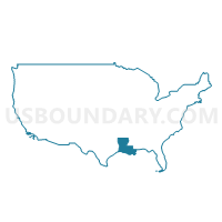
Coordinating & Development Corporation 3--Bossier & Webster Parishes PUMA, Louisiana
About
Outline

Summary
| Unique Area Identifier | 193024 |
| Name | Coordinating & Development Corporation 3--Bossier & Webster Parishes PUMA |
| State | Louisiana |
| Area (square miles) | 1,482.06 |
| Land Area (square miles) | 1,433.09 |
| Water Area (square miles) | 48.97 |
| % of Land Area | 96.70 |
| % of Water Area | 3.30 |
| Latitude of the Internal Point | 32.69767950 |
| Longtitude of the Internal Point | -93.49760400 |
Maps
Graphs
Select a template below for downloading or customizing gragh for Coordinating & Development Corporation 3--Bossier & Webster Parishes PUMA, Louisiana


Neighbors
Neighoring Public Use Microdata Area (by Name) Neighboring Public Use Microdata Area on the Map
- Coordinating & Development Corporation 1--Shreveport City (North) PUMA, LA
- Coordinating & Development Corporation 2--Shreveport City (South) PUMA, LA
- Coordinating & Development Corporation 4--Northwest Louisiana PUMA, LA
- South Central Arkansas PUMA, AR
- Southwest Arkansas PUMA, AR
Top 10 Neighboring County (by Population) Neighboring County on the Map
- Caddo Parish, LA (254,969)
- Bossier Parish, LA (116,979)
- Miller County, AR (43,462)
- Webster Parish, LA (41,207)
- Columbia County, AR (24,552)
- Claiborne Parish, LA (17,195)
- Bienville Parish, LA (14,353)
- Red River Parish, LA (9,091)
- Lafayette County, AR (7,645)
Top 10 Neighboring County Subdivision (by Population) Neighboring County Subdivision on the Map
- District 9, Caddo Parish, LA (27,649)
- District 8, Caddo Parish, LA (24,142)
- District 4, Caddo Parish, LA (21,976)
- District 1, Caddo Parish, LA (20,040)
- District 3, Caddo Parish, LA (15,077)
- District 6, Bossier Parish, LA (12,694)
- District 5, Bossier Parish, LA (11,961)
- District 12, Bossier Parish, LA (10,721)
- District 10, Bossier Parish, LA (10,377)
- District 2, Bossier Parish, LA (10,245)
Top 10 Neighboring Place (by Population) Neighboring Place on the Map
- Shreveport city, LA (199,311)
- Bossier City city, LA (61,315)
- Minden city, LA (13,082)
- Red Chute CDP, LA (6,261)
- Springhill city, LA (5,269)
- Eastwood CDP, LA (4,093)
- Haughton town, LA (3,454)
- Benton town, LA (1,948)
- Sibley town, LA (1,218)
- Cullen town, LA (1,163)
Top 10 Neighboring Unified School District (by Population) Neighboring Unified School District on the Map
- Caddo Parish School District, LA (254,969)
- Bossier Parish School District, LA (116,979)
- Webster Parish School District, LA (41,207)
- Claiborne Parish School District, LA (17,195)
- Bienville Parish School District, LA (14,353)
- Red River Parish School District, LA (9,091)
- Fouke School District, AR (5,782)
- Emerson-Taylor School District, AR (3,429)
- Bradley School District, AR (2,342)
Top 10 Neighboring State Legislative District Lower Chamber (by Population) Neighboring State Legislative District Lower Chamber on the Map
- State House District 8, LA (53,611)
- State House District 5, LA (47,695)
- State House District 9, LA (45,914)
- State House District 24, LA (45,792)
- State House District 6, LA (44,925)
- State House District 1, LA (44,917)
- State House District 7, LA (44,017)
- State House District 4, LA (42,975)
- State House District 13, LA (42,950)
- State House District 11, LA (42,174)
Top 10 Neighboring State Legislative District Upper Chamber (by Population) Neighboring State Legislative District Upper Chamber on the Map
- State Senate District 38, LA (120,165)
- State Senate District 36, LA (119,479)
- State Senate District 37, LA (114,690)
- State Senate District 39, LA (107,940)
- State Senate District 21, AR (74,633)
- State Senate District 26, AR (68,899)
Top 10 Neighboring 111th Congressional District (by Population) Neighboring 111th Congressional District on the Map
Top 10 Neighboring Census Tract (by Population) Neighboring Census Tract on the Map
- Census Tract 111.08, Bossier Parish, LA (11,727)
- Census Tract 240, Caddo Parish, LA (10,420)
- Census Tract 111.06, Bossier Parish, LA (8,379)
- Census Tract 210, Miller County, AR (8,063)
- Census Tract 110.01, Bossier Parish, LA (7,792)
- Census Tract 111.10, Bossier Parish, LA (7,417)
- Census Tract 111.09, Bossier Parish, LA (7,295)
- Census Tract 108.04, Bossier Parish, LA (7,278)
- Census Tract 321, Webster Parish, LA (7,135)
- Census Tract 106.01, Bossier Parish, LA (7,108)
Top 10 Neighboring 5-Digit ZIP Code Tabulation Area (by Population) Neighboring 5-Digit ZIP Code Tabulation Area on the Map
- 71111, LA (38,456)
- 71107, LA (33,800)
- 71112, LA (31,358)
- 71105, LA (21,907)
- 71055, LA (20,268)
- 71037, LA (19,325)
- 71104, LA (14,802)
- 71115, LA (14,506)
- 71006, LA (12,158)
- 71040, LA (10,268)


